Okay, maybe the title of this article is a bit abrasive, especially if you fall into the “dummy” camp, like I have been skirting around for the past couple of years. I mean no offence, and I want you to know that you are not alone. Though it seems like it should be a straightforward sniff test to be able to conclude that land is degraded, it is not so simple.
Forest degradation or land degradation are terms that are thrown around loosely in the nature-based solutions space. It is interesting that such an important condition in the carbon certification world is so poorly defined. It is after all, the baseline condition or challenge that nature-based solutions, or natural climate solutions are looking to solve.
As a forest project developer or an investor into reforestation projects, you become interested in this discussion if you want your activities certified – either for forest management or carbon. In both cases, you cannot be responsible for degrading forest through your activities. Certification Standards’ requirements to demonstrate the extent and timing of land degradation processes provide a safeguard against the financial incentive to degrade and then restore land to generate and sell carbon credits. But how do you prove when and how degraded a forest is – when walking out on site, clearly shows an ecosystem that is not performing at its best?
This article aims to provide some guidance for preliminary land evaluation to answer this seemingly simple question – is this forest degraded?
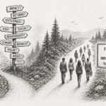
Step 1 – Talk to your Stakeholders
If you are originating a project for commercial reforestation, improved forest management, natural forest restoration, climate-smart agriculture or some other similar land-use that will restore productivity to the ecosystem, you need to understand what is important to the stakeholders in your project:
- Investors – What is important to an investor in terms of their wish to finance various restoration activities? Do they have their own definition of land degradation or preferred methodology to assess it?
- Local people – In the tropical forest context, it is likely that local livelihoods have contributed to continuous land degradation through traditional subsistence agricultural practices. Understand this driver of land degradation and their motives. Can local people be encouraged to adopt more restorative practices or take on alternative livelihoods?
- Certification standards – Do you plan on getting certified – either through forest management, carbon or other? Speak to an expert on what is required of the Standard of choice to meet eligibility requirements with respect to land degradation. How does the standard require you to demonstrate that you are not causing degradation, or converting an “less productive” natural ecosystem to an unnatural productive ecosystem?
Step 2 – Determine your Project Start Date
This may seem redundant, but it is a crucial point in your project timeline. It will mark the baseline condition of the ecosystem of your project. The point at which you need to demonstrate that the current composition of your project area is less productive than in the past. It will be the point from which you measure the impacts of your restoration activities in the future. If carbon certification is on your agenda, the project start date becomes tricky when a project has commenced ahead of certification – as it can be more difficult to prove eligibility on area that has already been developed, and you will be held responsible for the land use (including progressive degradation over the project area, even if it was not through your actions).
Step 3 – Go back in time
To demonstrate that your baseline condition is degraded, you will need to prove that it has lower ecosystem services and functions than at a justifiably selected point in the past. Assuming you are looking to meet the eligibility requirements of a carbon standard, it is important to understand the relevant Standard’s requirements with respect to historical ecosystem condition. For example, with the VCS Standard, ten years prior to project start date is an important marker (Eligibility criteria 3.2.4), where a developer needs to demonstrate that deforestation did not happen within the ten years prior to the project start (safeguard to prevent against conversion for the sake of carbon credit generation). You will then want to go back further still so that you can see the progression of land degradation. This is important to establish your ‘without project scenario’, as you can establish a trend and make the argument that this trend would continue in the absence of your project. The date in the past in addition to the ten-year marker, may be a practical one, and relate more to the availability of quality satellite imagery than to other factors.
Step 4 – Remote Sensing Analysis
At present, the simplest way to regard ecosystem condition change over time is to analyze satellite imagery, at the time points you selected, to demonstrate and quantify the change. Of course, historical imagery is not the highest quality, however, you have to work with what is available – and often this is why historical benchmark dates are often related to availability of data. In the preliminary phases of assessing historical land-use, publicly available low-resolution imagery is usually sufficient. You will need to work with a remote sensing specialist to carry out this assessment, where they are trained to classify land-use, often based on the Normalized Difference Vegetation Index (NDVI). Though oversimplifying it, NDVI provides a quantification of the amount of vegetation over a given area by measuring the difference between near-infrared (vegetation reflects) and red light (vegetation absorbs). You can breakdown the vegetation over a landscape into categories representing zero vegetation, such as rock and water to closed canopy forest, representing deep vegetation, of course with a spectrum in between. Observing and quantifying how this spectrum and land-use changes over time will show you just how degraded your project area is. There are limitations to this, but it is currently the best available method for understanding the past, especially in the tropics, where detailed forest or land-use inventories are rarely in existence, or are undependable.
Step 5 – Choosing a Remote Sensing Provider
If you are in the early stages of project development, you may not have remote sensing capacity at your fingertips and will need to engage a specialist. You can either work with a trained expert or sign on to service provision from one of the many remote sensing platforms that specialize in measuring land-use change. Some of the platforms that I am aware of include: FlintPro, Lens , and FARM-TRACE. I’m not a proponent of any one over the other, but there are several, and these are just a snapshot. If you are looking to engage an expert, or sign-on to a remote sensing service provider, here are some questions you might want to ask them:
- What resolution of satellite imagery do you have access to for the project area, and what will this cost? For purchased images, do I own the images, or do you own the images?
- What do you do in the case of poor-quality satellite imagery?
- How do you stratify land-use, and namely how do you quantify plantable and non-plantable land?
- Do you have experience with eligibility assignments, project document development and ongoing monitoring for X Certification Standard?
- How do you recommend that your remote sensing analysis is ground-truthed?
Step 6 – Assess the Forest Degradation of your project
You will employ the above steps to arrive at an understanding of the ecological condition (or level of degradation of your project area). This will provide you with a very informative baseline condition from which to structure your initial management planning (such as, which areas to plant and which areas to protect). It will also give you an indication of the quality of access, where roads are built (if any) in the project area, topographical constraints, and other key features, such as rivers/streams, and infrastructure or settlements. This information can also inform preliminary carbon projections and woodflow forecasts, among other aspects critical to commencing commercial reforestation projects.
Do you still have questions about assessing forest degradation?
Assessing forest degradation is not as straight forward as it seems. If you are a project developer trying to better understand the work required to get a carbon-certified commercial forest restoration project off the ground, or you are an natural climate solutions investor looking to better understand early-stage opportunities, please reach out.